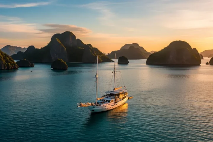
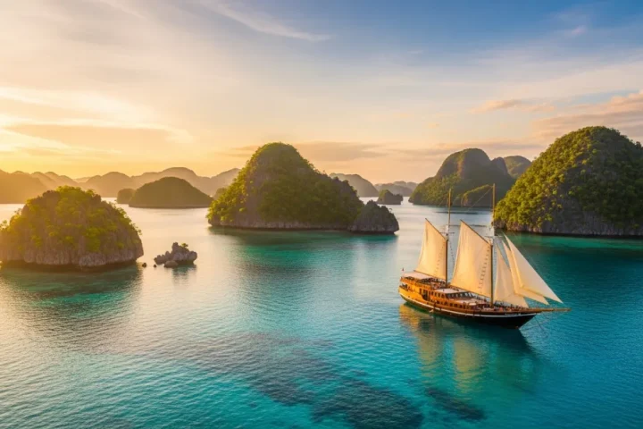
Kabui Bay is the sheltered, current-free half-day that most Raja Ampat itineraries undersell. It sits between Waigeo and Gam, a maze of limestone channels holding blue-water mangroves — an ecologically rare habitat where mangrove roots grow in clear ocean water rather than silt. Telaga Bintang, the star-shaped lagoon viewpoint, is the standard pairing.
Ask ten returning guests for their favourite half-day and a surprising number will name Kabui rather than a famous dive site. It is the day with no current, no schedule pressure and no need to be a diver — and it produces the photographs people actually frame.
What are blue-water mangroves and why are they rare?
Mangroves normally grow in murky, silty estuaries where rivers meet the sea. That is the environment most people picture: brown water, mud, mosquitoes, low visibility.
In parts of Kabui Bay the geology removes the silt. Water filters through limestone rather than arriving down a river, so the mangroves stand in clear, saline ocean water. The result is a habitat you can actually see into: red and orange root systems descending into turquoise, sunlight cutting through in bars, juvenile fish sheltering among the roots, small corals and sponges growing directly on the mangrove structure.
Ecologically this matters because mangrove systems are nurseries — the juveniles sheltering in those roots become the fish you see on the reefs. Finding that nursery function in water clear enough to observe is genuinely unusual, and it is one of the few habitats in Raja Ampat that is not primarily about depth or current.
Snorkelling here is shallow, still and slow. Visibility is lower than on the open reef and that is normal for the habitat rather than a bad day; judge it on structure and light instead of viz numbers, as our guide to visibility and conditions explains.
What is Telaga Bintang and how hard is the climb?
Telaga Bintang — “star lagoon” — is a small enclosed lagoon whose shape, seen from above, resembles a star. It has become one of Raja Ampat’s signature aerial and viewpoint images, and it is usually paired with Kabui Bay because they sit close together.
The viewpoint requires a short scramble rather than a hike: a landing by tender, then a climb of a few minutes up sharp, weathered limestone. Two honest warnings.
First, the rock is genuinely sharp — karst weathers into blades and points, and a slip means cuts rather than bruises. Closed shoes with grip, not sandals or dive booties. Second, the top is narrow and exposed, with no railings and a real drop. It is not appropriate for small children, anyone unsteady, or anyone attempting it in flip-flops for a photograph.
Guests who prefer not to climb miss very little. The lagoon itself is beautiful at water level, and the kayak routes through the surrounding channels are arguably the better experience.
What can you do in Kabui Bay?
| Activity | Time needed | Suits | Notes |
|---|---|---|---|
| Mangrove snorkelling | 45 – 90 min | All levels, weak swimmers | Shallow and current-free; wear a rashguard for sun and roots |
| Kayaking the karst channels | 1 – 2 hours | All levels | The best way to experience the passage; quiet enough to hear birds |
| Stand-up paddleboarding | 1 hour | Confident balancers | Excellent light-wind mornings; poor in any breeze |
| Telaga Bintang viewpoint | 30 – 45 min | Sure-footed guests | Sharp limestone, closed shoes essential |
| Tender cruise through the passage | 30 – 60 min | Everyone | Good option for guests skipping the water |
| Shallow reef snorkel nearby | 45 min | All levels | Cleaner water than the mangroves themselves |
The whole area works as a half-day, and it is one of the few stops where non-divers get the better deal. Our snorkelling sailing trip is built around days like this one.
When is the light and tide best?
Two variables, and they interact.
Light. Mangrove snorkelling wants sun high enough to penetrate the water — mid-morning to early afternoon is the working window. The karst channels, by contrast, photograph best at the edges of the day, when low light rakes across the limestone and the walls glow. A crew that schedules mangroves at 10:00 and kayaking at 16:00 knows what it is doing.
Tide. Higher water gives more clearance among the roots and lets kayaks reach further into the channels. Low water exposes root systems and makes some passages impassable — interesting to look at, harder to swim through. Tidal timing is why the same site can feel different between two visits.
For photographers, this is a wide-angle location with an unusual half-in half-out opportunity: a dome port at the surface among the roots produces the split-level frames that define the location. Settings and setup notes are in our underwater camera gear guide.
Where does Kabui fit in a 5-night or 7-night route?
Geographically Kabui sits conveniently between the Dampier Strait and the Fam Islands, which makes it a natural transit stop rather than a detour. Typical placement:
- On a 5-night trip: often a “if the tides cooperate” inclusion, slotted between the Dampier Strait days and the run to Fam. Worth asking about specifically, because it is the first thing dropped when a schedule tightens — see our 5D4N sailing package.
- On a 6- or 7-night trip: a comfortable half-day, usually a morning, before repositioning toward Fam and Piaynemo.
- On longer expeditions: often used as a gentle recovery day between demanding diving regions.
Sailing legs between central sites typically run one to six hours, so Kabui rarely costs a full day of movement. If it matters to you, say so at booking rather than hoping — the Piaynemo and Fam Islands trip pairs it naturally with the northern viewpoints.
What should you bring for a Kabui morning?
- Closed shoes with grip if you plan the Telaga Bintang climb.
- A long-sleeved rashguard — you will be at the surface in strong sun for an hour or more, and mangrove roots have barnacles.
- Mineral, non-nano sunscreen applied twenty minutes before entering the water. This is an enclosed, low-flush environment where sunscreen concentration matters.
- A dry bag for the tender.
- Water. It is hot, still and deceptively tiring.
And a reminder that applies everywhere in the archipelago: no touching, no standing on coral or roots, no anchoring on reef. The rules that come with your entry permit are covered in our guide to responsible sailing in Raja Ampat.
Frequently asked questions
What is Kabui Bay known for?
Limestone karst channels and blue-water mangroves — mangrove root systems growing in clear ocean water rather than silty estuary conditions, which is ecologically unusual and visually striking.
Is Telaga Bintang worth the climb?
For sure-footed guests, yes — it is the classic star-lagoon viewpoint. The scramble is short but the limestone is sharp and the top is exposed, so closed shoes are essential and it is not suitable for everyone.
Can non-swimmers enjoy Kabui Bay?
Yes. A tender cruise through the passage delivers most of the scenery, and the snorkelling area is shallow and current-free for anyone who wants to float with a buoyancy vest.
What is the visibility like in the mangroves?
Lower than on the open reef, and that is normal for the habitat. Judge the site on structure, light and root systems rather than on visibility numbers.
Is Kabui Bay included in most Raja Ampat itineraries?
On six- and seven-night trips usually yes; on shorter four-night trips it is tide-dependent and often the first stop dropped. Ask specifically if it matters to you.
Can you kayak in Kabui Bay?
Yes, and it is arguably the best way to experience the passage. Most sailing yachts carry kayaks or paddleboards, and the channels are sheltered enough for beginners.
Ask for the Kabui morning
If the mangroves and the karst channels are on your list, tell us at enquiry stage and we will make sure the tide window is planned in rather than hoped for. Charters are operated by Komodo Luxury, part of Juara Holding Group, sailing Indonesian waters since 2015.
WhatsApp: +62 811 3823 875 · Email: [email protected]